|
Michael A. Stecker
|
|
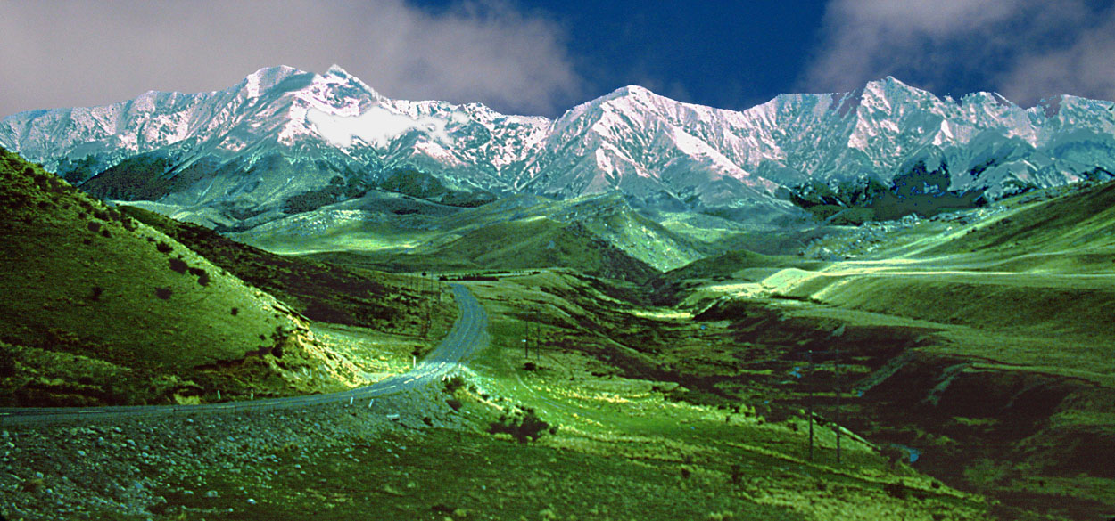
Eastern approach to Arthur's Pass
Arthur's Pass National Park (approximately 250,000 acres)
was created in 1929, the third in New Zealand after
Tongariro and Egmont. Straddling both sides of the main
divide, Arthur's Pass, named after surveyor Arthur Dudley
Dobson, is the main crossing of the Southern Alps by road
and railway, linking Canterbury and Christchurch to the West
Coast. The park remains an easily accessible alpine area
with beautiful fields of alpine flowers, native forests, and
wild mountains. East of the divide the landscape shows some
of the classic features of the eastern Southern Alps:
extensive scree-covered slopes, and wide braided
river-valleys (Waimakariri, Poulter rivers).The mountains
and valleys of Arthur's Pass National Park were heavily
glaciated during the ice ages, and the land has retained
many distinctive glacial features, such as tarns, cirques
and hanging valleys. The mountains to the east of the summit
are generally below 6500 feet except for Mt. Franklin 7037
ft and Mt. Oates 6739 ft.
|