|
Michael A. Stecker
mike@mstecker.com
Home
Places Index
North America Index
Bryce
Monument Valley
Colorado
Great Sand Dunes NM
Photo Album
Slide Show (PDF)
Slide Show (ProShow)
digiphoto
photomas
Places Index
Alaska
Albuquerque balloons
American Samoa
Antarctica
Astronomical Sites
Australia
Austria Bryce
Canada
Capital Reef
Chile
China
Clouds
Colorado Egypt
England
Flowers Great Sand Dunes NM
icebergs
India
infrared
Israel
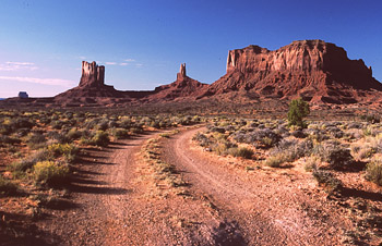
Monument Valley
Nepal
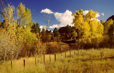
New England's autumn leaves
New Zealand
scenic treasures
Switzerland
Tahiti
Thailand Western Samoa
Yosemite in Spring
Yosemite in Winter
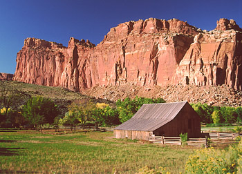
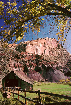
Capital Reef National
Park
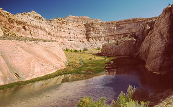
Sixty-five million years ago, while forces inside
the earth were pushing up the Colorado Plateau, a 90-mile-long break in
the earth's mantle was formed in what is now south-central Utah. Thousands
of feet of subterranean sedimentary rock were thus forced upward. As the
fold developed, twisting and buckling resulted in a convoluted range of
mountains we now call the Waterpocket Fold (called a monocline by
geologists). Today, after a great deal of erosion, the mountains rise less
than two thousand feet above the desert floor and extends from the
Fishlake Mountains in central Utah to Lake Powell (Colorado River) in the
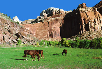
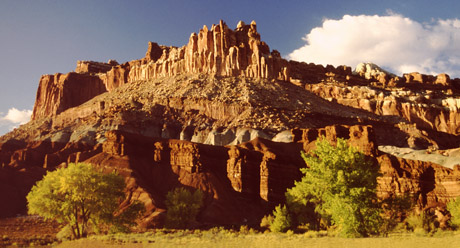
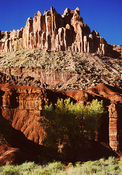
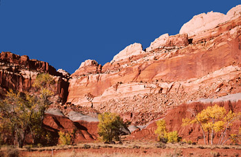
south. Most is preserved in Capitol Reef National Park, which contains
multicoloured cliffs, canyons, arches, spires and domes. The park gets its
name "Capital" from the many whitish sandstone domes that resemble the
U.S. Capital building, while "Reef" refers to the high uplifted ridge
running north-south along the fold. Its main road (Utah Hwy 24) from
Fruita to Torrey crosses the park east-west. It gives you a general idea
of its nature and passes close to several of the most famous named
features, such as the deep twisting canyon formed by Sulphur Creek,
Freemont River and Hickman Bridge. However, it is well worth the time to
drive the ten mile scenic toll-road which follows the reef itself past
huge multicolored cliffs and Capital Dome. The road ends at the start of a
narrow steep-walled canyon (Capital Gorge) that extends for several miles
south. A foot trail runs along its base and passes some ancient Indian
petroglyphs. The park, second largest in Utah, is much less visited than
others because of its remote location.
|